Land Survey
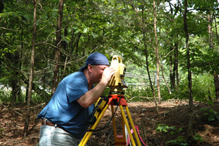
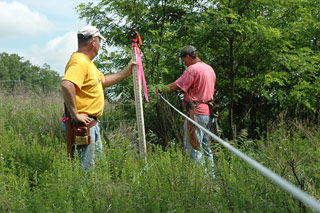
Welford Engineering employs a Licensed Surveyor, support staff and field staff that are able to perform a variety of survey services for your project. Each survey technician has undergone a strict regimen of training and constantly strives to maintain and improve their technical proficiency.
Boundary Line Survey
Welford Engineering will perform a Boundary Line Survey for the property to determine the precise limits of the property to be included in a project. The Boundary Line Survey will meet the requirements of the Commonwealth of Virginia and be suitable for recording if desired. Typical services for a Boundary Line Survey include:
- Boundary research in the land records office of the governing jurisdiction;
- Field surveying to locate any existing property line monumentation for the site;
- Computation of site boundaries based on obtained record information, information provided by the client, and the performed field survey;
- Identification of encumbrances in the property title report provided by the client; and
- Completion of a Boundary Line Survey Plan for the site which shows the metes and bounds of the property.
Topographic Survey
The purpose of a Topographic Survey is to gather survey data about all natural and man-made features within a specified parcel of land, including its elevations. From this information a three-dimensional map is prepared. A Topographic Survey is recommended when accurate as-built drawings and surveys for a property are not available, especially when considering purchasing or developing the subject property. Typical services for a Topographic Survey include:
- Aerial survey techniques (contracted out by Welford Engineering) or field shot topography. All above ground improvements will be located.
- An additional ground survey will be completed to document the utilities as built in the area of the site.
- The survey will be completed so that base plans can be produced at the required scale and contour interval.
Base Plan Preparation
Base Plans are prepared to facilitate the development of a sound conceptual site plan that takes into account all potentially applicable conditions. To produce a solid Base Plan, Welford Engineering will combine the Boundary Line Survey and Topographic Survey and add information to them from a variety of existing sources which further completes the picture of the site. The following types of information are included in the Base Plan:
- Property line information for adjacent parcels to the site;
- Identification of adjoining properties owners of record;
- Flood plain information;
- County soils information;
- Identification of Resource Management Areas and Resource Protection Areas applicable to the project;
- Identification of easements;
- Wetland information and delineation for water resources on or near the site;
- County records of sewer and water facilities on or near the site; and
- Information from VDOT on the status of any planned improvements to roads and highways in the vicinity of the site that may have an impact on the site’s development.
House Location Survey
A House Location Survey is used in the transfer of real estate in the State of Virginia. It is a technical drawing that specifies the boundaries of a lot, the location and outline for the home, and the location of any other structure on the property including fences, easements, and other characteristics of the property. Title companies and lenders will require a House Location Survey when a home buyer uses mortgage financing to purchase the home. These surveys are helpful to the new homeowner for many additional purposes after the purchase has been completed. In the case of a claim against the property owner for encroachment, the survey will show the condition of the property and boundaries at the time the owner purchased it. It shows utility easements which can help homeowners avoid damaging utility lines when installing additions or landscaping. Surveys conducted at purchase can also be used for approximately 10 years to satisfy county permitting requirements when obtaining a permit to install fencing or other home improvement. Homeowners can use the survey when they decide to sell their home as well. Welford Engineering is happy to provide this type of survey to a potential homeowner at any time.
ALTA/ACSM Land Title Survey
For a survey of real property and the plat or map of this survey to be acceptable to a title insurance company for purposes of insuring title (and therefore to a lender for the purposes of supplying financing for a project), certain specific and pertinent information must be presented in the survey for the distinct and clear understanding between the client, the title insurance company, and the surveyor. These standards are set by ALTA (the American Land Title Association) and the ACSM (the American Congress on Surveying and Mapping, a member of the National Society of Professional Surveyors). An ALTA/ACSM Land Title Survey combines elements of a Boundary Line Survey and Topographic Survey with additional requirements that go above and beyond state standards. Welford Engineering Land Surveyors have a great deal of experience and expertise in the preparation of ALTA/ACSM Land Title Surveys that meet the requirements of title insurance companies and lenders, enabling a development project to move forward from concept to fruition.
Construction Stakeout
Welford Engineering can provide survey stakeout services for every type of construction project. Our thorough stakeout services are tailored to the specific project and can include any of the following elements as applicable:
Earling Grading and E&S Construction
- Limits of Construction
- Construction Entrance
- Sediment Traps
- Sediment Basins
- Riser and Outfall for Sediment Basins
- Topsoil Stock Pile
Final Site Construction
- Limits of Construction for SWM Ponds
- SWM Pond
- Bio Retention Facilities
- Retaining Walls
- Site for Rough Grade
- Centerline of the Access Road for Rough Grade
- Building Pads for Rough Grade
- Building – For Construction
- Building Brick Nails
- Building Column Lines
- Access Road for Construction
- Sanitary Sewer
- Storm Sewer
- Water Line
- Curb & Gutter
- Edge of Pavement
As-Built Survey
Construction
An As-Built Survey is conducted several times during the construction project to verify, for local and state boards, that construction work has been completed to the specifications as set forth on the Site Plan. This usually entails a complete survey of the site to confirm that the structures, utilities, and roadways proposed were built in the proper locations authorized by the Site Plan. As-Built Surveys are usually done 2-3 times during the building of a house or other facility; once after the foundation has been poured; once after the walls are put up; and at the completion of construction.
Storm Water Management Facilities:
Inspect SWM Facility and provide certification that the ponds meet design specifications.
Bio Retention Facilities:
Inspect the Bio Retention Facility and provide certification that it meets design specifications.
Utility Survey:
Perform a record survey of the location of the water and sewer constructed on the site as shown on the plans.

